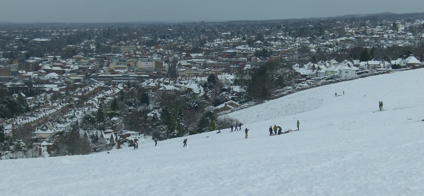

The Mount's downland, Wanborough and East Clandon are in the final Surrey Hills extension order, now with ministers. Blackwell Farm and Shalford are out.
The downland slope on The Mount, above Guildford town centre, is in the final order to extend the Surrey Hills. So are the farmland below the Hog’s Back at Wanborough, the whole of East Clandon village with Hatchlands Park, and Chilworth.
Natural England sent the order to the Environment Secretary on 7 September. It adds about 129 square kilometres to the protected landscape, an increase of 30.5%. The Secretary of State can confirm it, change it or refuse it, and there is no set timescale for the decision.
The order itself is one paragraph. It designates the land “shown edged dark purple and shaded purple” on maps at 1:25,000, and it was sealed on 20 August 2026 (the Order). What is in and what is out is only on the maps, which are published as images. We read the four maps that cover Guildford borough against Natural England’s written boundary report, and they match.
The Guildford land going in
| Area | What the order adds | Map |
|---|---|---|
| The Mount, Guildford | Open chalk downland between The Mount and Farnham Road, down to the backs of the houses on Wodeland Avenue | Map 3 |
| South of Woodcote, Guildford | Two arable fields off Woodcote lane, near Piccard’s Farm | Map 3 |
| Hog’s Back lower slopes | Farmland and ancient woodland from the edge of Tongham to Misley Copse, east of Wanborough, including all of Wanborough Conservation Area | Map 2 |
| Hatchlands and East Clandon | East Clandon village, Hatchlands Park, Upper Hammonds Farm and land north of the A246 at West Horsley Place | Map 6 |
| Merrow Downs edge | A small block at Guildford Golf Club | Map 6 |
| Chilworth | The village and the valley around it, up to the edge of Shalford | Map 3 and Map 5 |
Wanborough is about four miles west of the town centre, East Clandon about four miles east and Chilworth about three miles south-east.
The Mount
This is the one most people in the town will know. It is the grass slope that runs down from the lane called The Mount towards the houses above Farnham Road.
Natural England’s boundary report says the land “comprises an area of open chalk downland, which slopes towards the urban edge”. It “sits above the urban area and forms a sweep of landscape up to the built edge” (Boundary Review, updated report September 2025, section 5.1).
The current boundary runs along the lane. The new one comes down the hill to the property boundaries on Wodeland Avenue.
The allotments beside it are left out. The report says they “have an urban fringe character and relate more strongly to the urban edge”.
Hog’s Back
The biggest Guildford addition is the band of farmland and woods on the north side of the Hog’s Back. It runs from Poyle Road on the edge of Tongham, past Wanborough, to Misley Copse, west of Down Place.
The report says the line takes in “the whole of the Wanborough Conservation Area and associated listed buildings” and large areas of ancient woodland.
East Clandon and Hatchlands
Here the existing boundary cuts across open fields without following anything on the ground. The new line moves north to the A246, then jumps it to take in East Clandon village, the National Trust’s Hatchlands parkland and the ancient woodland north of the park.
After the 2024 consultation, Natural England added more land on the margins of Hatchlands and north of the A246 at West Horsley Place.
Chilworth
Chilworth is the one village that goes in although it did not meet the test itself. The report says drawing a line around it “would be overly convoluted”, because the village is small, narrow and surrounded by qualifying land.
What was left out
Several pieces of Guildford land were considered and deliberately kept out.
- Blackwell Farm. The Local Plan housing site west of the town (site allocations 26 and 27) is excluded in full. Natural England’s guidance says allocated land on the margins of a qualifying area should be left out. The line was moved west of Down Place so it follows a track on the ground.
- The solar farm site near Wildfield Copse. Planning permission (24/P/00441) was granted during the review, and the copse was taken out as a result.
- Backside and Broadstreet Common. The flatter secondary woodland falling towards the railway was judged “not considered to be outstanding”.
- The villages of Tongham, Ash Green and Flexford, along with their allocated sites.
- West Clandon and West Horsley, which stay outside the line.
- Shalford, excluded following the natural beauty assessment.
- Horse paddocks south of Warren Road, judged to relate more to the urban edge than the countryside.
How it got here
The review has taken five years. Natural England’s consultation page sets out the dates:
- 2021: Natural England announces its landscape designation programme
- 2023: first statutory consultation, more than 1,500 responses
- 17 September to 10 December 2024: second consultation, more than 375 responses
- 21 November 2025 to 14 January 2026: formal notice period
- 20 August 2026: Natural England seals the order
- 7 September 2026: order submitted to the Secretary of State
What it means for you
Nothing changes on the ground until the Secretary of State confirms the order. There is no deadline for that decision.
Once confirmed, the land becomes part of the Surrey Hills Area of Outstanding Natural Beauty, now branded a National Landscape. Public bodies, including the council deciding planning applications, must then “seek to further the purpose of conserving and enhancing the natural beauty” of the area (Countryside and Rights of Way Act 2000, section 85).
That does not stop development on its own. It is a factor every decision-maker has to weigh. How it sits with the borough’s grey belt review, which we reported last week, will be tested application by application.
If you live near one of these areas, you can check exactly where the line runs:
- the four maps linked in the table above show every field at 1:25,000
- paper copies are held at Guildford Library, according to the GOV.UK notice
- questions go to Natural England at SurreyHillsAONBboundaryreview@naturalengland.org.uk
For planning applications near the new boundary, see our guide to Guildford planning applications.
Have your say